We are building Open Pit mine end-to-end Product.
Crystalball Mining end to end product
1. Data Collection
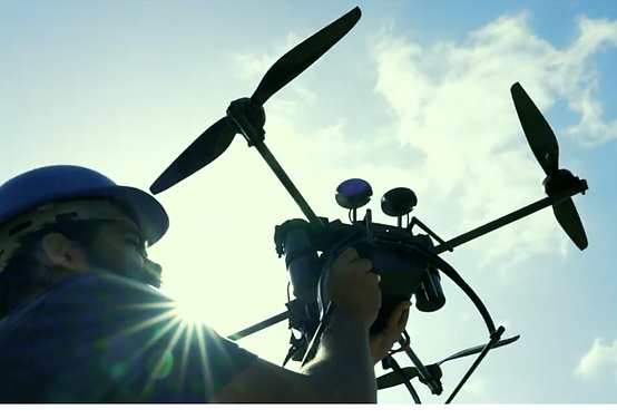
The CrystalBall Model M drone is specifically designed for mapping open-pit mines

Drone pilot
2. Data Processing
CrystalBall Mapping Processing software ( CBMAP) is designed for accuracy and efficiency

GIS
Engineer

Photogrammetry Engineer
3. Data Analytics
CrystalBall Mining Intelligence (CBMI) transforms open pit data into actionable mining insights


Mine Engineer
GIS
Analyst
Operations
Head
Data Collection

.png)

.png)
Model M captures high-resolution aerial imagery with a focus on accuracy. It is light weight and easy to use. It uploads raw data to CrystalBall cloud real-time and connects to CrystalBall Processing solution seamlessly.
.png)
Real-Time Cloud Sync
Real time data upload during flight
5G Connectivity
Compact and Lightweight
Portable design that makes transportation and operations effortless.
Be airborne within 2 minutes
One-person operations
.png)
.png)
Precision Data Capture
Achieves 4 cm accuracy at 2 cm/pixel GSD & 80 meter altitude with our proprietary rover module.
RTK Enabled
Sensor fusion for better accuracies
Efficient Workflow Integration Data Capture
Streamlines data collection and processing
Direct integration with Data Processing
Saves time and manual efforts
.png)


.png)
.png)
.png)
.png)
.png)


.png)
.png)
.png)
.png)
.png)